
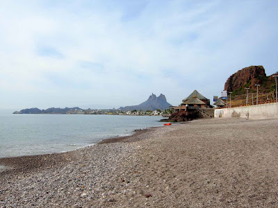
View from the dining bar, looking toward the city of Guaymas.

Picture of the restaurant area, taken from the bar area.

The restaurant is at the end of this little beach, perched on the rock.


 Life is good in the shade of palm trees.


 OK, we're trying a new method to blog our pictures. John has been using Google earth to "look around" and we found we can take these snapshots and then include them here. The pics in the previous blogs about the marinas can be explained here. The marina where we stayed before is that narrow inlet at the bottom of the sweeping bay on the left of the pic. The central San Carlos harbor/marina in that large natural enclosed bay in the center.
 One condo building under construction
the other is finished.
There is a large marina in central San Carlos but we drove out to "Marina Real", about 3 miles out from San Carlos, where we were on our boat in 2000. The roads in this area on which the houses in the foreground are now located were under constuction when we were here back then. There are now many very nice waterfront homes. We took this panoramic picture of the marina area to try to capture that area. There is a multi-story condo building under construction on this large bay. It is the white square shaped object in the distance, breaking the tree line around the bay, you can slightly see it in the distance. It's an area where gringos and well-to-do Mexicans own, mostly, vacation homes. The only homes there when we were there before were those on the little spit of land in the center of the pic.  The beach here, Playa Esmerelda, is a beautiful small inlet to the south of Marina Real. Friday was a little cloudy, Saturday was clear and warmer. We're planning to spend the day there Sunday if the weather is at least as warm.
 He is heading to Puerto Vallarta to work for six months, and maybe longer, as a boat broker. That's Dan's truck/camper behind us. We only traveled together as far as San Carlos as he wants to arrive in PV by Saturday. We bid him Adios, agreeing to meet up in January when we are in that area.
 Mexico's Highway 15 is a fine road with 3" shoulders (yikes!!) and occasional widespots. The topography in this region is, obviously, a continuation of southern Arizona. We passed a very large vineyard area and many cattle ranches. We are pleased to be back in San Carlos, where we spent the month of September 2000. We are staying at a very nice campground owned by Joseph, a 30-something Mexican who speaks accent-free perfect English, who we've heard is an internet aficionado, and to whom we thank for the great Wi-Fi connection! We'll explore around tomorrow and post some pics.

